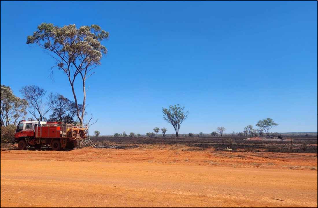
Four bushfires in the Far West district were still being patrolled as of yesterday afternoon after what’s been a horrendous weekend for firefighters.
Rural Fire Service (FRS) Far West Team District Manager Inspector Brad Lennon said the fires broke out following a dry lightening front that passed through on Thursday night.
Inspector Lennon said by Saturday RFS brigades and volunteers were on heightened operations as they battled eight grass fires (and two other structure fires) in a 24 hour period.
He said the conditions on Saturday were exacerbated by strong winds and the high temperature, with the thermometer reaching a scorching 43.7 degrees.
“There was concern at one stage that two fires might join up but thankfully that did not happen,” Inspector Lennon said.
Volunteers from the Euabalong, Geandale, Canbelego, Cobar Headquarters and Nymagee rural fire brigades, contractors with heavy machinery and bulk water carriers and multiple landholders with their own farm fire fighting units were called upon to help with crews working in shifts around the clock.
“Our last night shift finished at 3am this morning,” Inspector Lennon said in an interview yesterday.
He said no assets (buildings or machinery) were lost to the fires.
As of yesterday, Inspector Lennon said the fire grounds at Booroomugga Station between Girilambone and Canbelego (which burnt out approximately 1,197 hectares), at Warella Station north east of Bourke (1,007ha), at Torrale in the national park (600ha) and at Glenariff in the Byrock area (228ha) were all still on patrol.
“The conditions have subsided and are now more favourable,” he said.
“We are expecting another front tomorrow [Wednesday] and Thursday that may cause issues, but really don’t know until we get it.”
Inspector Lennon said they were assisted with managing the fires by Digital Earth Australia Hotspots (a national bushfire satellite imagery monitoring system), aircraft flying over the fire area mapping where fire had been and where it was going, as well as amazing volunteers and property owners.
“We greatly appreciated everyone involved for their around-the-clock efforts,” Inspector Lennon said.