survey program. ▪ Photo contributed
Local residents may see or hear a helicopter flying over the skies throughout the shire from next Monday which is conducting an aerial survey.
The airborne survey is to help map buried geological features including possible minerals and groundwater in the Cobar–Lake Cargelligo region.
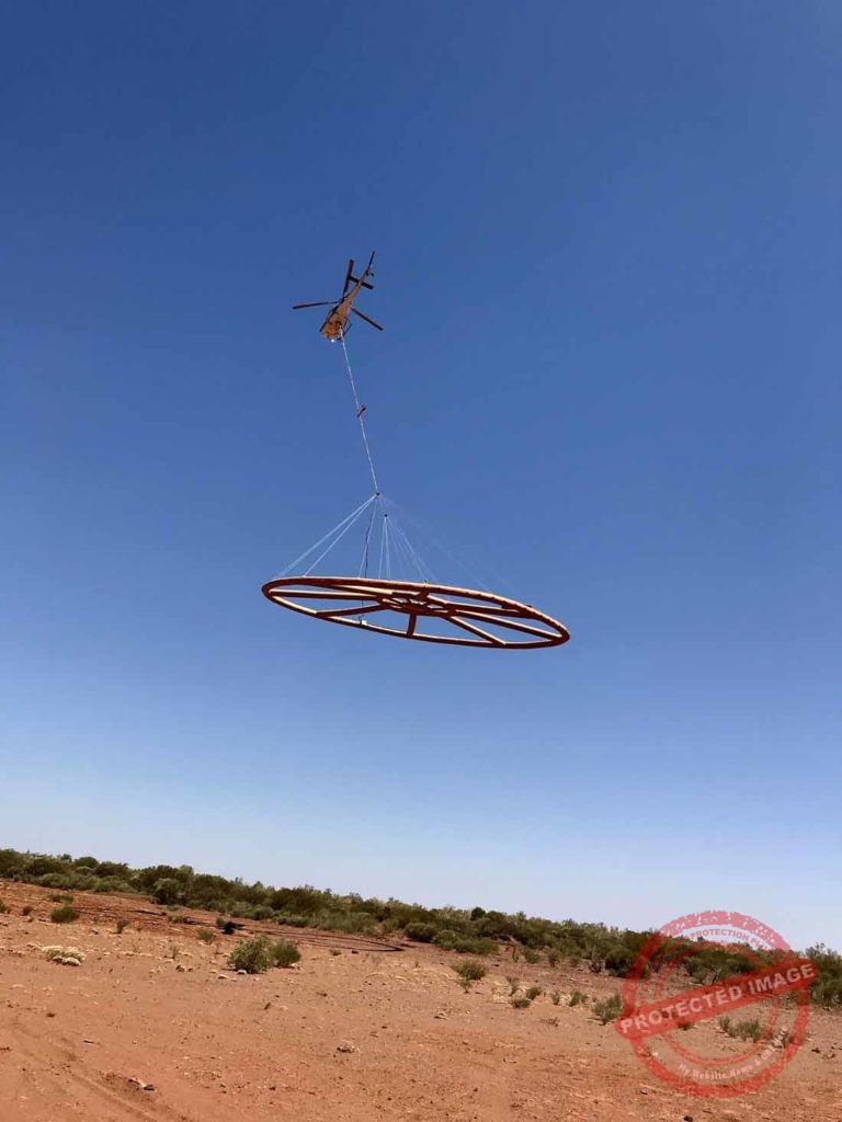
The Geological Survey of New South Wales Executive Director Dr Chris Yeats said a helicopter equipped with a large sensor will be flying at low altitude during surveying and also at higher altitudes while its flying to and from survey areas.
Dr Yeats said the helicopter will fly on east–west lines up to 5km apart, during daylight hours (weather permitting) as the survey progressively moves through the Cobar-Lake Cargelligo region between September and November.
“The sensor looks like a giant wagon wheel and is a curious thing to see flying through the air if you don’t know what it is,” Dr Yeats
said.
“The survey helicopter will fly at a height of about 60 metres with the sensor suspended 30 metres below, with the flight path avoiding towns, buildings, towers, livestock and steep terrain.”
The survey area includes unpopulated areas near to Cobar, Euabalong, Euabaong West, Gilgunnia, Lake Cargelligo, Louth, Mount Hope, Naradhan, Nymagee and Rankins Springs.
Dr Yeats said the airborne electromagnetic (AEM) survey will measure the natural electrical properties of rocks and soils to a depth of around 400 metres.
The information collected will provide insight about underground geology, potentially including undiscovered mineral and groundwater resources.
He said this could include the location of new deposits of high tech metals such as copper and gold, which are vital components in the manufacture of renewable energy technologies and smartphones.
Surveys are needed to detect new underground sources of these metals as it is unlikely there are any significant deposits left to discover on the surface.
The Geological Survey of New South Wales and Geoscience Australia are coordinating the survey and have contracted
flight operator New Resolution Geophysics, as part of the MinEx Cooperative Research Centre’s National Drilling Initiative.
Dr Yeats said New Resolution Geophysics wrote to landholders in August to advise them about the survey.
For further information about the survey see the advertisement on this page.